Surveys Showing the Old Brick Church on the
State Road from Rushville to Carthage, and
Location of the Bridge Over Middle Creek
In the earliest days of Illinois Statehood, roads were layed out by acts of the state legislature, and surveys were sometimes authorized. A State Road was layed out from Rushville to Carthage, by act of the Illinois General Assembly, in 1833.
A bridge was authorized in 1837 by the Hancock county commissioner's court, as follows: "Ordered that Daniel A. Fullerton be appointed an agent to let out the building of a bridge across the first ravine east of Carthage on the state road from Carthage to Rushville. The bridge to be fourteen feet wide with good mud sills and bents at each side with cafs sills and five string pieces or sleepers covered with substantial white oak puncheons, with suffcient hand rails, and aprons at each end, laid on string pieces corresponding with those on the bridge. To be entirely above high water, not to exceed fifty dollars for building." This description is probably similar, if not the same, as the bridge over Middle Creek on the State Road.
A State Road Act dated March 3, 1835, required no survey for a new road; it simply called for three suitable persons to view the proposed location, followed by setting stakes, or ploughing furrows to mark the road's position, and make a report. In 1849, the Township Organization Law was adopted in Hancock County. The surveys shown below appear in Carthage township's road record book.
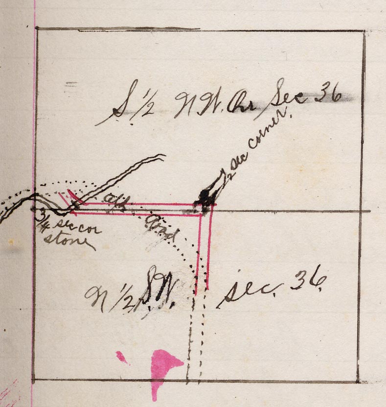
The old State Road from the Old Brick Church to the Bridge over Middle Creek is described in an 1890 survey by Douglas Aleshire, as follows: "Commencing at the brick church and running in a south easterly direction about 40 rods until it intersects the old road at the bridge." An additional description given by Douglas Aleshire is as follows: "Commencing at the west end of the bridge, thence north 44 degrees west 9.44 chains to the intersection of the road on the section line between Sections 35 and 36 near the brick church."
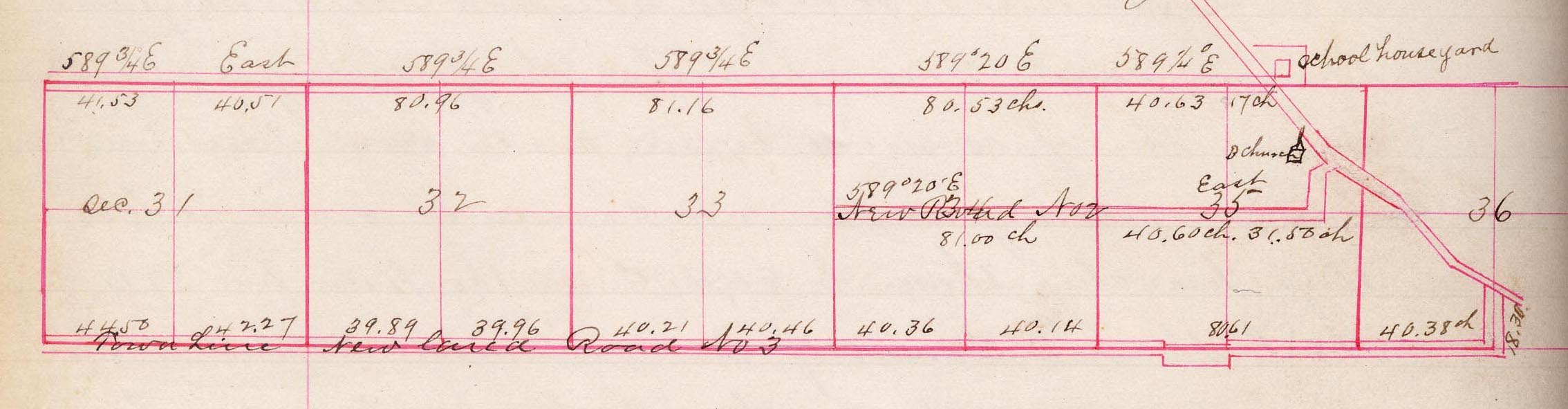 The 1866 Survey by Joshua C. Berry, above, shows the location of the Old Brick Church, and how the State Road angled in a southeasterly direction past the church at that time.
A survey in 1896 by J. H. Horney, shows further change in the old State Road, in the sections southeast of the church and cemetery.
Copyright c. 2008-2023. All rights reserved. The Primitive Baptist Library.
